Ocean Mapping 101 - What is Ocean Mapping all about?
So you're interested in Ocean Mapping? You've come to the right place!
This section will introduce you the concept of Ocean Mapping, and by the end of this module you should have learned:
-The history of Ocean Mapping
-Why we seek to map the ocean floor
-How Ocean Mapping is executed
Where did Ocean Mapping get it's roots?
Ocean mapping is a concept for which has been in practise for hundreds of years, with those who professionally determine features regarding the
nature of the sea bed and its characteristics being hydrogrpahic surveyors. Ocean Mapping began with the simple process of dropping a lead weight into
the ocean with it attached to a rope. Depth would eventually be commonly measured in fathoms. In modern times, the application of the sextant
allowed for the precise determination of position when acquiring depth measuremnts or "soundings". Into the 20th century, we find the invention of
sonar, revolutionizing the Ocean Mapping field of work.
Why map the ocean?
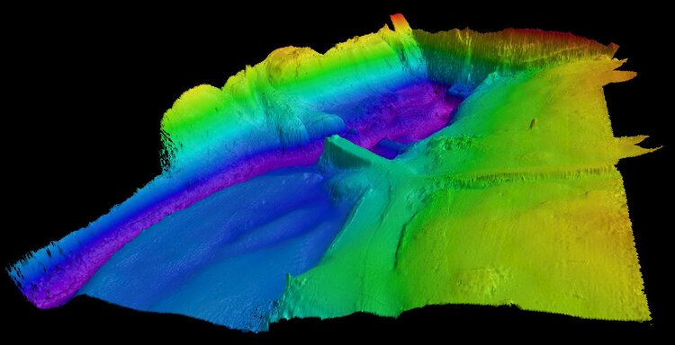
Ocean mapping allows for surveyors to gather depth readings on the ocean floor, and with the development of sonar usage it is now possible to create a near perfect
image or representation of what the seas floor looks like. Using these "images" of the sea floor highly detailed nautical charts may be createed for use in piloting
vessels, they may be used for industrial purposes such as underwaters pipelines and cables, or used by other scientists in the hydrography field for purposes such as environmental research.
Having knowledge of the characteristics of the ocean floor is vital to almost any given line of work or reserach involving the ocean.